Starting point: Mylopotamos village.
It is no coincidence that the majestic lagadia is the island’s number one tourist attraction, making Kythira one of the most enviable islands to possess such a rare treasure. The rich flora of Kythira is created by the morphology of the soil, a legacy of the island’s location between Crete and the Peloponnese.
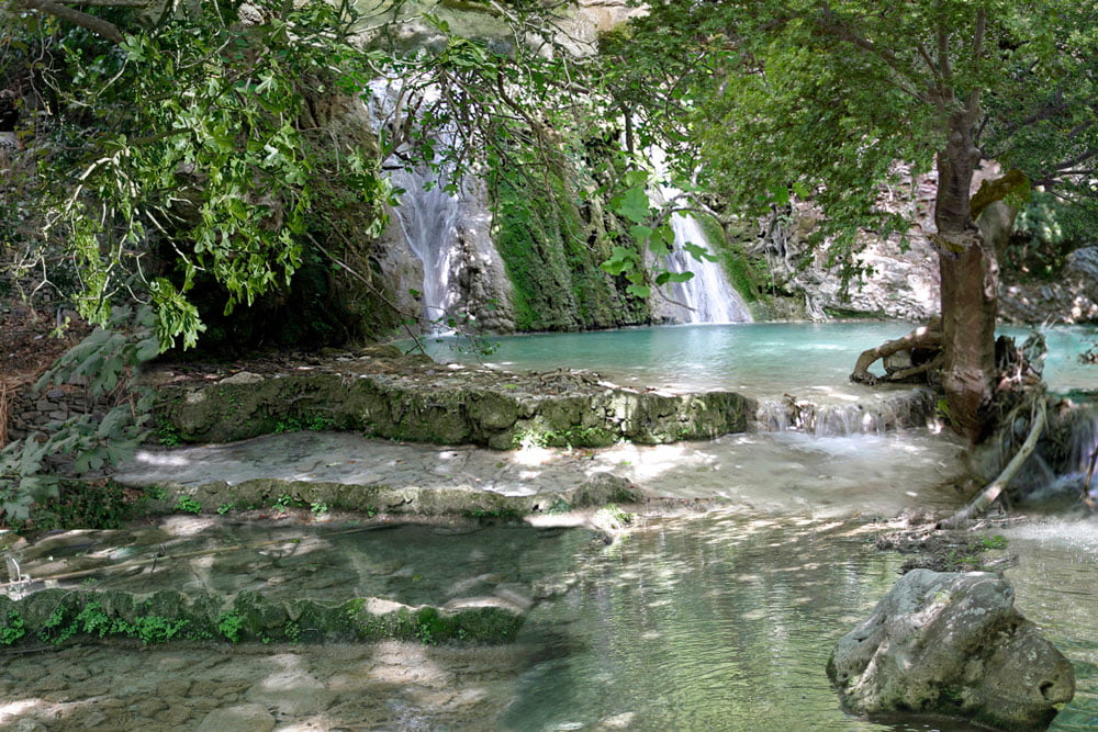
Lagkadies carved by the flow of water, on the surface of the plateau, created over time wonderful natural environments with rich vegetation, and abundant running water, which in the past were the raw material for commercial activity by the inhabitants of the island.
Starting from the central square of the traditional village of Mylopotamos with its three huge plane trees, the waters soften from the Kamari spring following a secret course between reeds, laurels, wild roses and centuries-old plane trees, creating small natural lakes, whose waters are poured by small waterfalls , composing a wonderful natural landscape, which becomes unique with the traditional watermills, and the stone arches and bridges.
The Mills continue to bear witness from the past to the harmonious human presence with nature, which through the passage of time, managed to become a model of ecology, and an example for the correct behavior of modern man in his relationship with nature.