Home » Kythira Information » Antikythira Mechanism
The Antikythera Mechanism

GPS from the 2nd century BC!
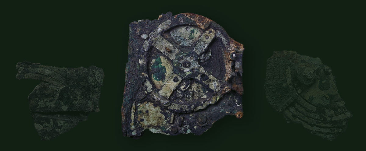
The first GRS (Global Positioning System) built in history was none other than the famous Antikythera Mechanism. The elaborate mechanism could determine the longitude of each region and serve to create reliable maps, from the 2nd c. e.g.
This finding, made by the scientists of the Astrophysics Laboratory of the University of Athens, takes on particular importance as the determination of longitude in the Western world was officially established a few decades after the death of Isaac Newton, i.e. at the end of the 18th century! Some, of course, have argued that the method of calculating longitude had been discovered by the Chinese since 1433 AD. Longitude is one of the two magnitudes of geographic coordinates that are used today to determine the location of places, ships, planes, and even people. Its measurement is based on the prime meridian, which is known to be the one that passes through the Greenwich observatory.

It worked as a global positioning system.
But in the ancient Greek world of the 2nd century BC. neither Greenwich existed nor of course the meridian that runs perpendicular to it. Greek astronomers had identified a meridian that passed through Rhodes and Alexandria and was used to calculate the distance and location of various destinations. In this way, and with the help of the mechanism, it was possible to create new maps that included new areas and to determine exactly where they were in relation to Greece.
Mr. Xenophon Mousas, associate professor of Space Physics and director of the Astrophysics Laboratory, tells “NEWS” that “the Antikythera mechanism was able to determine the longitude of various regions by taking advantage of finding the position of the Moon in the sky.” More specifically, “when a ship set out with the intention of measuring the longitude in Syracuse or Gibraltar, the navigator set the position of the Moon in the mechanism as it appeared in the sky of the area from where he set sail, say Rhodes. In other words, he was finding the position of the Moon in relation to the position of some bright star he was seeing at that time, e.g. of Sirius. When the ship was at Syracuse or Gibraltar after a few days, the navigator would measure the difference in the Moon’s position between the mechanism’s prediction, which showed them where the Moon was on Rhodes, and the actual position of the Moon they saw in the sky. From the resulting difference, he determined the longitude of the area where he was.” In every port he touched, in every country he reached, the navigator could know the difference in longitude from the place from which he started. With such a machine he could certainly know precisely not only how far away the place he was going was, but also which direction he should follow in order not to find himself elsewhere. According to Mr. X. Moussa, the mechanism was used to create maps in the ancient world, which even depicted with amazing accuracy the time, positions and distances of countries and continents.

Hipparchus was 1,700 years ahead!
Mr. Charalambos Kritzas, archaeologist and former director of the Epigraphic Museum of Athens, studied the letters engraved on the mechanism and concluded that it must have been manufactured since 150 BC. until 100 BC
It was the time when the father of Astronomy, Hipparchus, lived in Rhodes. The Rhodian astronomer was a leading thinker, and the first to calculate the diameter of the Moon and its varying distance from the Earth. In addition, he had calculated the variable angular velocity of the Moon which the mechanism accurately represents. This practically means that if Hipparchus built the mechanism, then he had found Kepler’s second law, 1,700 years earlier.


